Southampton’s subsurface tells two very different stories depending on where you stand. North of the M27, the chalk bedrock of the South Downs sits close to the surface beneath a thin veneer of clay-with-flints, creating stiff conditions that favour shallow foundations. Cross south towards the Itchen estuary and you encounter the Bracklesham Group—interbedded sands and clays overlain by thick sequences of river terrace gravels and soft alluvium that can exceed 10 metres depth in places. This dramatic shift over just a few kilometres makes seismic tomography an invaluable reconnaissance tool for anyone planning ground investigation in the city. By measuring compressional and shear wave velocities through the subsurface, refraction and reflection surveys map the transition between these geological units without the need for extensive drilling programmes. For projects near the docks where made ground from historic land reclamation complicates the picture, combining seismic data with targeted CPT testing provides a calibrated ground model that reduces uncertainty before excavation begins.
A single seismic refraction line across a suspected solution feature in Southampton chalk can save tens of thousands in unexpected piling variations.
Technical details of the service in Southampton
Risks and considerations in Southampton
BS 5930:2015+A1:2020 and Eurocode 7 (BS EN 1997-2:2007) place explicit emphasis on deriving geotechnical parameters from field measurements rather than correlation tables alone, and this is where seismic tomography proves its worth in Southampton’s complex ground. The city straddles a transition from the Wessex Basin chalk to the Hampshire-Dieppe Basin Tertiary deposits, a setting where buried channels filled with soft organic silts and peat lenses are a known hazard—the old course of the River Itchen left several such features beneath the city centre. A seismic refraction survey that reveals a low-velocity trough cutting through otherwise competent strata is often the first indication of a palaeochannel that could compromise a piled foundation or deep basement. The risk of missing these features with boreholes alone is amplified by the high cost of urban re-drilling; a tomographic cross-section costs a fraction of a mobilisation and provides continuous coverage between investigation points. For earthworks adjacent to the M271 or the rail corridor, reflection profiling also helps identify the depth to groundwater perched on clay layers within the London Clay Formation, a critical input for slope stability calculations under BS EN 1997-1 Design Approach 1.
Our services
Seismic tomography surveys in Southampton are configured to match the site constraints and the geological target. The choice between refraction and reflection—or a combined approach—depends on depth of investigation, required resolution and site access.
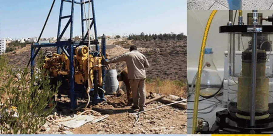
Seismic refraction profiling
Determines depth to engineering rockhead and maps lateral variations in chalk competence across the site. Ideal for foundation design and earthworks planning on sloping sites near the Itchen valley.
Shallow seismic reflection
Delivers higher stratigraphic resolution in the upper 40 metres for detecting buried channels, peat lenses and the interface between terrace gravels and the Bracklesham Beds. Effective on constrained brownfield plots.
Cross-hole seismic tomography
Provides detailed P-wave and S-wave velocity profiles between boreholes for critical infrastructure projects. Used to image dissolution features and assess rock mass integrity beneath proposed deep foundations.
Vs30 site classification surveys
Combined refraction and MASW data acquisition for seismic site classification per BS EN 1998-1. Essential for projects in Southampton where the ground type varies from class B (chalk) to class D (alluvium).
Questions and answers
What does a seismic tomography survey cost for a typical Southampton site?
For a standard seismic refraction survey covering one or two 69-metre lines—sufficient for a typical residential or light commercial plot in Southampton—the cost ranges from £2,490 to £4,360 depending on access conditions and the number of shot points required. Larger sites needing multiple lines or combined refraction and reflection acquisition will fall towards the upper end of this range. All quotations include data processing, interpretation and a factual report with velocity cross-sections suitable for submission to building control.
Can seismic tomography detect solution features in the chalk beneath Southampton?
Yes. Solution pipes and dolines in the Seaford and Newhaven Chalk formations create distinct low-velocity anomalies in a refraction profile—typically a localised drop of 30–50% in P-wave velocity compared to adjacent competent rock. The method detects features wider than approximately half the geophone spacing, so a 3-metre spacing can resolve pipes of around 1.5 metres diameter or larger. For detailed imaging of smaller dissolution features, cross-hole tomography between boreholes provides higher resolution.
How long does a seismic refraction survey take on site?
A single 69-metre refraction line with a 24-channel seismograph and sledgehammer source can be acquired in 60 to 90 minutes by a two-person crew, assuming reasonable ground conditions. A typical Southampton site with two to three lines is usually completed within a single working day. Data processing and interpretation takes an additional two to three days in the office. The main variable on site is ground coupling—loose made ground or tarmac surfaces may require drilling shot holes or using a weight drop source, which extends the acquisition time.
What depth of investigation can seismic tomography achieve in Southampton's geology?
Refraction surveys using a sledgehammer source typically reach depths of 25 to 35 metres in the chalk and Tertiary deposits found across Southampton, while a weight drop or accelerated weight drop source can extend this to 50–60 metres. Reflection profiling with a hammer source generally resolves features down to 40 metres. The practical limit is governed by the seismic velocity gradient—in the relatively high-velocity chalk (Vp > 2,100 m/s), the refracted wave travels efficiently, whereas the overlying low-velocity alluvium in the river valleys attenuates signal and reduces penetration depth.