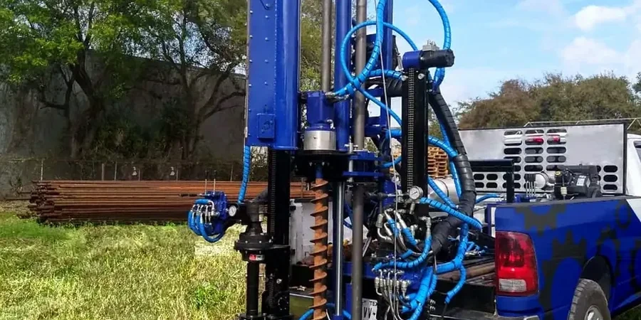
Southampton’s geology shifts sharply within half a mile – from the stiff clays of the Bracklesham Beds underlying the city centre to the loose river terrace deposits along the Itchen and Test estuaries. Over 250,000 people live above this patchwork of soils, and every new foundation in postcodes SO14 to SO19 must contend with it. The Standard Penetration Test remains the most direct method for measuring relative density and consistency in these strata. Our crew runs a calibrated automatic trip hammer on a crawler rig, recording blow counts every 150 mm down to 30 metres where access allows. For deeper profiling through the gravels that cap the Whitecliff Bay sands, we often pair SPT with a CPT test to capture continuous tip resistance data without losing the soil sample. The result is a defensible set of N60 values that structural engineers can plug straight into bearing capacity calculations under Eurocode 7.
An SPT N-value taken without noting the groundwater level on a Southampton estuary site is worse than useless – it’s misleading.
Technical details of the service in Southampton
Demonstration video
Risks and considerations in Southampton
Southampton’s post-war expansion pushed housing onto the floodplains of the Itchen and Test, where 19th-century maps show water meadows and tidal creeks. The made ground in these zones contains brick rubble, ash, and dredged silt – materials that deliver erratic SPT results. A blow count of 15 at two metres depth might suggest medium-dense sand, but if the sampler hits a buried concrete slab fragment, the reading is a phantom. We flag every instance of refusal or sudden jump in the log. More dangerous is the misreading of pore pressure dissipation in the tidal silts of the Test estuary. A rapid test sequence in low-permeability soil traps excess pore pressure, artificially reducing the N-value. Our operators maintain a controlled rate of testing and log the time between blows when soils approach the liquid limit. BS 5930 calls for cautious interpretation in these conditions; we deliver a narrative log, not just numbers.
Our services
Each SPT borehole generates a soil profile, but the value lies in how that profile is read. We structure our service around two deliverables.
SPT borehole logging and sampling
Crawler-mounted rig with automatic hammer, split-spoon sampling at 1.5 m intervals, full groundwater monitoring, and soil descriptions to BS 5930. Includes transport to our lab for index testing.
N60 interpretation and foundation report
Raw field N-values corrected for energy ratio, rod length, borehole diameter, and overburden pressure. Presented alongside bearing capacity estimates for shallow and piled foundations under Eurocode 7.
Questions and answers
How much does an SPT test cost in Southampton?
A single SPT borehole to 10 metres depth in the Southampton area typically falls between £410 and £570, depending on access conditions and whether the rig needs to cross gravel or made ground. Mobilisation within the city is included. Deeper holes or multiple locations adjust the figure; we provide a fixed-price proposal after a desk study of the site's geology.
How many boreholes do I need for a house extension in Southampton?
For a typical two-storey rear extension on a 50 m² footprint, one borehole to 8–10 metres is usually sufficient, provided the ground conditions across the site are consistent. If the BGS mapping suggests a transition between Bracklesham Beds and river gravels, we recommend two points to capture the change in bearing stratum.
What depth should an SPT borehole reach for a two-storey building?
We target a depth of at least 1.5 times the width of the loaded area below foundation level. For a strip footing on a two-storey structure, that commonly means 8–10 metres from ground surface. In Southampton's estuary silts, where a deeper compressible layer may exist, we extend the hole to 12 metres to check for the presence of dense gravel or bedrock.
How do you handle the high water table near the River Itchen?
We record the strike level during drilling and the stabilised level after 20 minutes. In granular soils below the water table, we slow the withdrawal of the rods to minimise suction effects that can disturb the sample. The field log notes the depth of water ingress, and the corrected N60 values account for the reduced effective stress below the phreatic surface.
Do you provide the corrected N60 values or just the raw blow counts?
We deliver both. The field log shows the raw blow counts for the second and third 150 mm increments, plus any refusal. The interpretive report applies corrections for hammer energy (60% standard), rod length, borehole diameter, and overburden pressure. This dual reporting lets the design engineer see the original data and the adjusted values used in the analysis.